D’Aguilar Range District
Locations
Maps
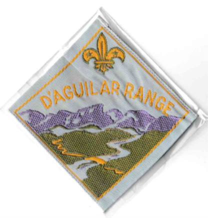
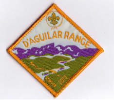
Badge Description
Scout logo
Purple Hill = D’Agular range hills which are part of the Great Dividing Range
Blue water = Caboolture River flowing out into the bay
Bridge = Captain Whish Bridge named after Captain Claudius Buchanan Whish (1827-1890), a soldier, sugar-planter and Inspector of Road Surveys. He was believed to be the first successful sugar producer in Queensland.
The badge was first issued in 1970 [2]
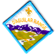
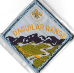
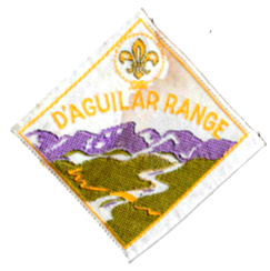
Previous Badge Variations
The following are variations of the badge:
 |
 |
 |
 |
|
Type: Woven bound |
Type: Woven bound |
Type: Ribbon |
Type: Woven bound |
|
52 x 50 mm |
50 x 50 mm |
50 x 50 mm |
52 x 50 mm |
|
Current |
Ext |
Ext |
Current Uniform & Commemorative Anniversary 1969-2013 |
History
D’Aguilar Range district is named after the town of “D’Aguilar” which is named after Major General George Charles D’Aguilar a military officer who wrote “Regulations and Punishments of the British Army”, the army textbook in use at the time of the town’s establishment.
D’Aguilar Range district was established in 1969, and prior to this was part of Murrumba district [1]. The District Commissioner in 1969 was K. Grehan [1]. Prior to the Northern Moreton Bay Region being formed, the district was part of the South East Queensland Zone, which was administered by Branch Headquarters in Brisbane, and districts were supported by Field Commissioners [2, 3]. In 1972, the districts within this Zone included: Maryborough, Maheno, Gympie, Cooroora, Beaver Masters, Nambour, D’Agular Range, Murrumba, Bunya, Barambah, Condamine, Dolphin, South Coast, Stradbroke Island and Beaudesert districts. In 1980 D’Aguilar Range district become part of Southern and Western Region [4].
Local Scout Event
Raftarama – Annual Scout event
Local Places, Events and Activities of Interest
Caboolture Warplane Museum; Woodford museum; Woodford Folk Festival; D’Agular Range Mt Mee Drive & Lookout; Kilcoy Heritage & Museum; Caboolture Historical Village; Abbey Museum of Art & Archaeology (Caboolture); Bribie Island Seaside museum; Caboolture Region Environment Education Centre (Burpengary)
Groups
D’Aguilar Range District Groups (1969): Bribie Island Scout Group, Caboolture Scout Group, Kilcoy Scout Group, Woodford Scout Group [1]
D’Aguilar Range District Groups (1971): Bribie Island Scout Group, Caboolture Scout Group, Kilcoy Scout Group, Woodford Scout Group [5]
D’Aguilar Range District Groups (1983): Bribie Island Scout Group, Caboolture Scout Group, Kilcoy Scout Group [6]
D’Aguilar Range District Groups (2018): Bribie Island Scout Group, Caboolture Scout Group, Morayfield Scout Group, Woodford Scout Group [7]
D’Aguilar Range District Groups (2019): Bribie Island Scout Group, Caboolture Scout Group, Morayfield Scout Group, Woodford Scout Group, Beachmere Scout Group
D’Aguilar Range District Groups (2024): Bribie Island Scout Group, Caboolture Scout Group, Morayfield Scout Group, Woodford Scout Group, Deception Bay Scout Group
References
- Scouting in Queensland (1969). “Warrant Changes”. Vol. 8 (6), July, p.20.
- Haskard, D. (1983). The complete book of Australian Scout badges: Part 2, Queensland and Papua New Guinea. Chatswood, NSW: Badgophilist Publications. p. 10.
- Scouting in Queensland (1972). “South-East QLD Zone Conference”. Vol 11 (6), July, p. 5.
- Scout (1980). “Coming Regional Events: Central and Coastal Region”. Jan-Feb, p.47.
- The Boy Scouts Association, Queensland Branch (1971). Area, group and district directory 1971. Abel & Co.
- The Scout Association of Australia, Qld Branch. (1983). Directory: Areas, Regions, Districts, Groups 1983.
7. Scouts Australia, Queensland Branch (2018, March 7). Formation listing 2018. Retrieved from https://scoutsqld.com.au/members/formation-listing/
