Daisy Hill Forest District (Ext)
Locations
Rochedale , Shailer Park , Slacks Creek , Springwood , Underwood
Maps
Rochedale , Shailer Park , Slacks Creek , Springwood , Underwood
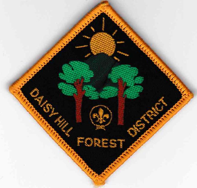
Badge Description
Scout logo
Rising sun over the hills plus 2 trees = Daisy Hill which is the main natural feature in the district
Badge issued in March 1986 [3]
History
Daisy Hill Forest district is named after an estate formerly owned by the Dennis family. They were first Europeans to settle at Daisy Hill. James Dennis immigrated in 1864 on the ship Flying Cloud. In 1867, he married Mary Ann Markwell. Around 1870 they began selecting land in the now Daisy Hill area, eventually acquiring over 320 hectares (800 acres). They named the property Daisy Hill, supposedly because their daughters saw daisies growing on the hill.
Daisy Hill Forest district was established in 1st July 1985 as a result of a three way split of Logan District into Albert Lindesay Logan Central and Daisy Hill Forest districts, and was last mentioned in Brisbane South Area directories in 1988 [1, 2, 3]. The district became extinct in 1989, and was merged with Logan Central district to form Logan City district [3]. This area is now known as Toohey Forest District.
References
- The Scout Assoc of Australia, Queensland Branch (1985). Brisbane South Area Directory
- The Scout Assoc of Australia, Queensland Branch (1988). Brisbane South Area Directory
- Ripon, R. (2002). Australian Scout Badge Varieties in Alphabetical Order (Australian National, New South Wales, Queensland). Victoria, International Badgers Club. p. 167.
