Mulgrave District (Ext)
Locations
Maps
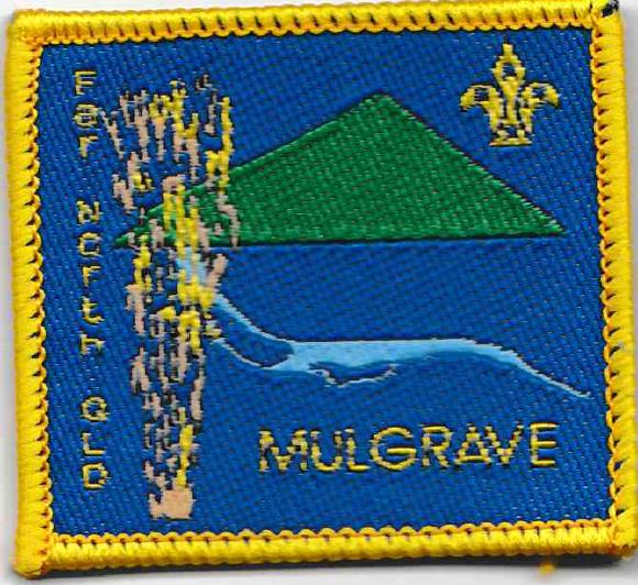
Badge Description
Scout logo
Sugar Cane = local agriculture
Hill = Walshs Pyramid “Bundadjarrugal” (922m), Gordonvale
Light River Blue line = Mulgrave River running parallel to Gillies Range Rd at Gordonvale
History
Mulgrave district is named after the Mulgrave River which was named by the explorer George Elphinstone Dalrymple in 1873 after the family antecedents of the Governor of Queensland, the Second Marquess of Normanby, who was styled Earl of Mulgrave before succeeding to his father’s title. On 16 November 1940, the Shire of Cairns was renamed Shire of Mulgrave.
Mulgrave district was formed in 2001 [1, 2, 3], and their first major district activity was JOTA 2001. The district was de-registered on 9th August 2006 [4]. In 2003, the District Commissioner was Victor Dawson [5].
Groups
Mulgrave district Scout Groups (1999): Gordonvale Scout Group, Edmonton Scout Group, Bentley Park Scout Group [2]
Mulgrave district Scout Groups (2003): Bayview Scout Group, Gordonvale Scout Group, Edmonton Scout Group, Bentley Park Scout Group [5]
References
- Digweed, p. Region Commissioner, Far North Region. Personal communique 17.2.2018
- Whittington, H. Group Leader, Northern Beaches Scout Group, Far North Queensland. Personal communique 17.8.2018
- History of Mulgrave JOTA & JOTI. In Mulgrave District JOTI & JOTA 2002 CD. Located at BP Park, Heritage Centre.
- Scouts Australia, Queensland Branch. Electronic archive database retrieved 8 April 2018
- Scouts Australia, Queensland Branch (2003, November 6). Formation listing 2003.
