Palmerston District (Ext)
Locations
Maps
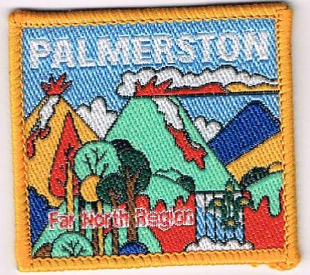
Badge Description
Scout logo
Mountains : Bellenden Ker Range depicting Mount Bartle Frere and Mount Bellenden Ker.
History
Palmerston district is named after Christie Palmerston, an Australian explorer. He led several expeditions during the last quarter of the nineteenth century including the discovery of a route along the Mowbray River, which eventually led to the founding of Port Douglas. Palmerston lies within the Wooroonooran National Park, which is part of the Bellenden Ker Range and includes Queensland’s two highest mountains, Mount Bartle Frere (1622 m) and Mount Bellenden Ker (1592 m).
Palmerston district was formed in 1999 [1, 2], and was de-registered on 9th August 2006 [3]. In 2003, the District Commissioner was Sheila Doyle [4].
Groups
Palmerston district Scout Groups (1999): Malanda Scout Group, Ravenshoe Scout Group [2]
Palmerston district Scout Groups (2003): Millaa Millaa Scout Group, Ravenshoe Scout Group [4]
References
- Digweed, p. Region Commissioner, Far North Region. Personal communique 17.2.2018
- Whittington, H. Group Leader, Northern Beaches Scout Group, Far North Queensland. Personal communique 17.8.2018
- Scouts Australia, Queensland Branch. Electronic archive database retrieved 8 April 2018
- Scouts Australia, Queensland Branch (2003, November 6). Formation listing 2003.
